New Show App
20 January 2017
ConExpo-Con/Agg and IFPE 2017 have created a new mobile app to help show goers pre-plan their show visit and stay aware of what’s going on.
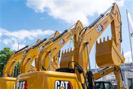
The new show app, sponsored by CAT, has beacon technology and features interactive 3D maps to help attendees navigate the show floor. The app is designed to sync with the online show planner and attendees can create a personalised agenda of exhibits they want to see, education seminars and meetings they would like to attend, and edit it both before and at the show.
Attendees can also use the show app to:
• Stay connected with real-time show notifications
• Access the shows’ high-value news content
• Participate in gamified show activities to earn prizes
• Network with fellow attendees
• Share updates, photos and video via social media
To download the app, search ConExpo-Con/Agg on your mobile app store.
Exhibits and Education
With the show app/online show planner, attendees can:
• Search for exhibitors by company name, type of product or market area, booth number, geographic location, location on the show floor and exhibitors new to the show
• Find new products faster through the New Products and Technologies exhibitor preview and the new Tech Experience participant preview
• Check out education sessions (including content and speaker details)
“Customers are increasingly turning to mobile platforms for convenience and ease of use," said George Taylor, Vice President of Caterpillar's Marketing & Digital Division. "Cat is excited to power the trade show's first mobile app enhanced by beacon technology, helping attendees make the most of their time in Las Vegas."