GPS and drone tech speeds up project

07 April 2021
Drone and GPS technology helps speed up construction of a residential development in Germany
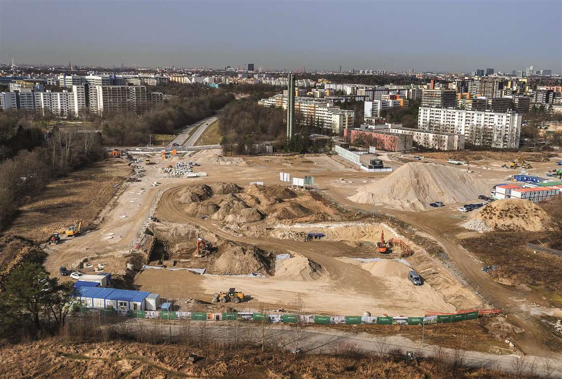 Bauer Umwelt removed 25,000 m³ of material to create the excavation pit for the Pandion Verde project in Germany.
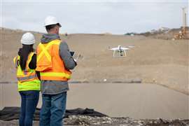
Bauer Umwelt, the environmental division of Bauer Resources, has used an aerial drone and GPS technology to survey and construct an excavation pit for a residential development in Germany.
The Pandion Verde project comprises the construction of three residential complexes in the Neuperlach District on the outskirt of Munich. It will see a total of six houses and 256 apartments built on an area of around 20,000m2.
Bauer Umwelt used the drone to survey the construction site much faster than traditional methods. Detailed images taken by the Phantom 4RTK drone were used to evaluate the amount of material that needed to be moved.
According to the company, which has now completed construction of the excavation pit, use of the drone also, “revealed a discrepancy of a few centimetres between the excavation pit and the design.”
Identifying this early meant that Bauer Umwelt was able to address the discrepancy and avoid any resulting problems when carrying out the works.
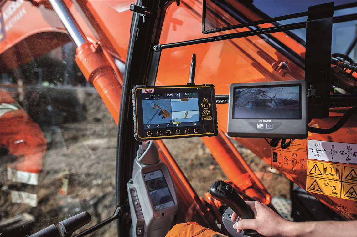 After using a drone to survey the Pandion Verde site, Bauer Umwelt’s GPS-controlled excavator carried out the precision excavation works.
Jan Uhlig, operations manager for Bauer Umwelt Division, said, “A comparatively simple pit construction, but still a true highlight in terms of digitalisation.
“It had a real advantage in terms of speed. Manual surveying methods often take up several days while a drone flight takes just a few minutes and the processing of the data just a few hours.”
After using the drone to survey of the site, Bauer used a 35-tonne Hitachi ZX 250 LCN-6 excavator to dig the rough foundations before completing the precision work with a GPS-controlled excavator of the same model.
The GPS-controlled machine generated a 3D model of the site, allowing the machine’s operator to monitor the progress of their work on an integrated display in real time. This meant that disruptions and delays could be minimised.
Bauer Umwelt said, “The GPS control also had a decisive edge in terms of time and cost savings: The excavator driver was able to work self-sufficiently without needing to rely on additional support staff at the site, such as a surveyor for allocating the stake-offs at specified heights of the excavation pit.”
In total the company removed 25,000m³ of material from the pit, which was excavated to a depth of 4m. This included the demolition and disposal of roughly 5,000m³ of concrete.
It also installed a 60cm thick filter layer to allow rainwater to discharge into the construction soil and the natural aquifer.
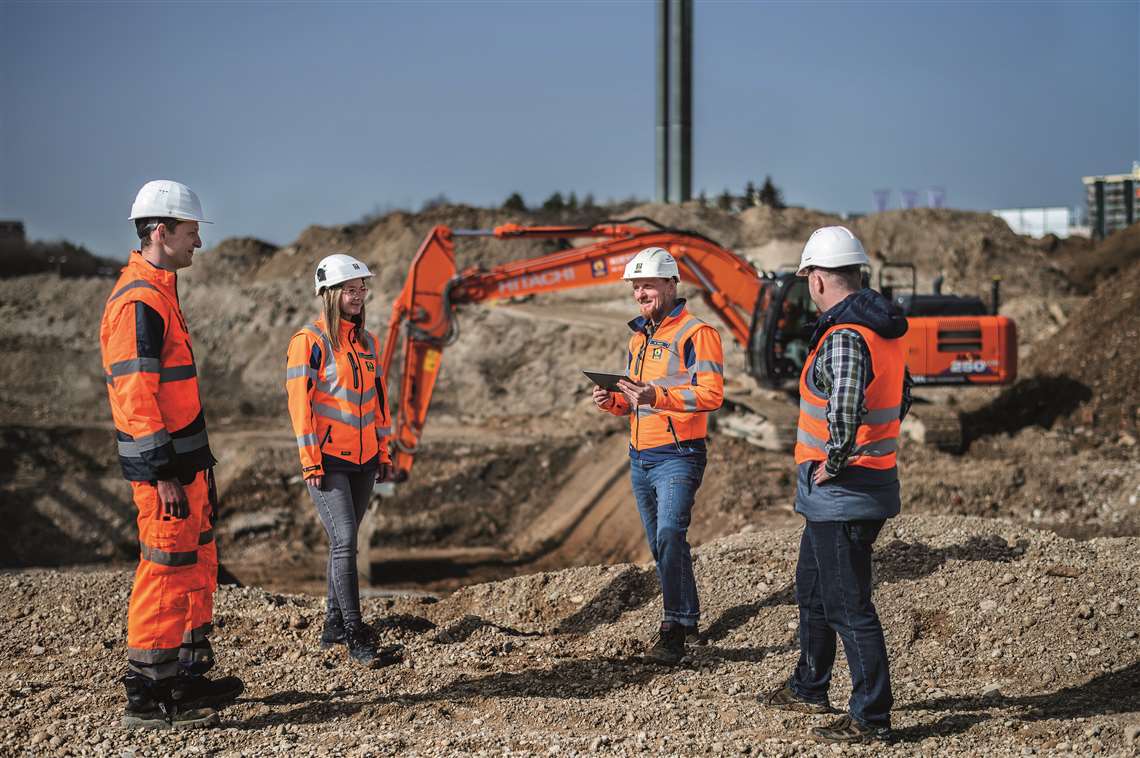 Bauer Umwelt’s project team on site: (left to right) excavator driver Thomas Erwert, site manager Rosa Arystanbaeva, senior foreman Erwin Resch and operations manager Jan Uhlig.