Trimble’s drone-based tech for construction
21 September 2020

Trimble is offering progress tracking software that combines with drone flights to aid the mapping, measurement and management of construction sites.
Sitech, a UK-based distributor of Trimble technology, says the data analytics and visualisation platform, Stratus – which is powered by worksite analytics software from Propeller – is designed specifically for earthmoving applications.
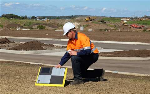
Using the technology in conjunction with Trimble’s Connected Site solutions, Sitech says contractors need only place and activate ground control points, then undertake drone flights to collect valuable site data, using Stratus to upload and view the data, which can be shared across teams working remotely.
Jan Wouter Kruyt, director of European Operations at Propeller, said, “While other software tries to accommodate a broad category of users, Trimble Stratus is 100% focused on earthmoving and construction environments. The cloud-based platform is also really intuitive and can be used without surveying expertise ─ the drone images are processed in Trimble Stratus and then visualised as an interactive, measurable 3D terrain models. It’s easy to create and share measurements on these 3D maps.”
Kruyt added, “The new package delivers several benefits for construction companies, including capabilities to compare designs and minimise rework by generating highly accurate survey data.
“Most importantly, having frequent up-to-date survey data on hand means that companies can complete projects ahead of schedule and under budget, something that’s becoming more important as companies try to get back on track following lockdown.”


