Geospatial portal created for Hinkley Point C

10 February 2023
EDF has used enterprise GIS from Esri UK to create a geospatial portal for Hinkley Point C (HPC) nuclear power station.
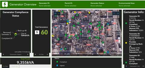 Overview of the portal (Photo: Esri UK)
The GIS portal is said to be a central source of all spatial data, maps, apps and dashboards, combining multiple sources of information and making them accessible to everyone on site. An interactive primary site map contains over 100 different data layers, from BIM models and CAD data including Revit models, to construction operations, temporary works, utilities, logistics and emergency preparedness.
Esri GIS is said to have enhanced HPC’s ability to collect data out in the field, replacing manual methods using paper checklists, clipboards and spreadsheets.
Future plans include using GIS to track and optimise the use of plant around the site to reduce emissions and make transport services more intelligent, by tracking the site’s buses and other vehicles.
“The scale of the project presents a complex logistical challenge,” said Jon Dolphin, Construction Project Manager and GIS Lead at HPC.
“Clarity of construction data is critical and the GIS portal provides a single view of this, which drives collaboration as people can see where things are happening and when. Every employee or contractor is making decisions based on the same data. The confidence this generates makes decision-making faster and strengthens the ability of teams to work more efficiently. As a result, we’ve seen improvements in quality, safety and productivity.”